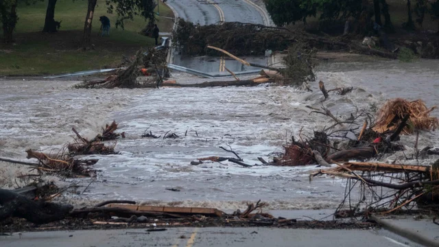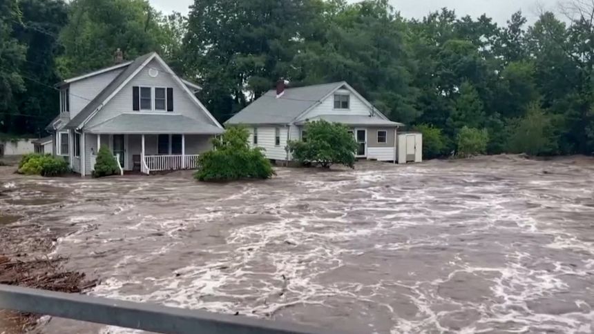
The Vermont flooding rain forecast for the middle of this week centers on a slow-moving system that will park itself over the region and refuse to move along quickly. Showers and thunderstorms arrive Tuesday, rain continues in waves through Wednesday night, and some locations in southern Vermont could pick up more than four inches before the whole thing finally clears out Thursday morning.
The concern is not the total by itself. It is how fast some of that water arrives.
What the System Is Doing
Slow-moving is the operative phrase here. When a system drifts rather than sweeps through, the same areas get hit repeatedly by rounds of rain rather than a single band that passes and ends.
That is the setup for Tuesday and Wednesday. Numerous showers and thunderstorms develop Tuesday, followed by periods of rain that persist into Wednesday night. Model guidance for Wednesday morning shows widespread downpours lining up along the Green Mountain spine, which is where some of the heaviest accumulations are expected.
By Thursday the system weakens and pulls away, though scattered showers may hang around after the main event has finished.
Where the Heaviest Rain Is Likely
Two areas stand out.
The eastern slopes of the Adirondacks and the southern and central Green Mountains carry the greatest risk. In both cases, terrain is doing the work.
When moist air is forced upward by rising ground, it cools, condenses and wrings out more moisture than it would over flat terrain. This is why mountain ranges consistently record higher rainfall totals than nearby valleys during the same storm, and why forecasters flag elevated terrain when a wet system is approaching. Air riding up the windward side of a ridge can turn a moderate rain event into a locally significant one.
Southern Vermont sits in the sweet spot for that effect this week, which is where the four-inch potential comes from.
How Serious Is the Flood Threat?
This is where the forecast requires some nuance, because the answer is genuinely mixed.
The most likely impact is the routine kind: water pooling on roadways, standing water in areas with poor drainage, and the usual headaches that come with that. Storm drains back up, low spots collect water, and driving conditions deteriorate for a while.
The risk of more significant flooding is comparatively low, and the reason is straightforward. Recent conditions in the region have been dry. Dry ground has capacity. Soil that has not been saturated by previous storms can absorb a meaningful volume of water before it starts running off into streams and rivers, which is the mechanism that turns heavy rain into flooding.
That said, forecasters are not ruling out isolated flash flooding, particularly during the Tuesday night into Wednesday window. The flash flood threat index for that period shows yellow shading across parts of the region, indicating roughly a 15 percent chance of significant flash flooding.
Fifteen percent is not a high number, but it is not a number to dismiss either. It means the ingredients are present and the outcome depends on details that are hard to pin down more than a day out, chiefly whether a training band of storms sets up over one particular drainage and stays there.
Why Dry Ground Only Helps So Much
It is worth understanding the limits of the dry-soil buffer, because it can create false confidence.
Absorption capacity depends on rainfall rate, not just rainfall total. Ground can take in a great deal of water spread across twelve hours and very little of the same amount delivered in ninety minutes. When rain falls faster than soil can accept it, the excess runs off regardless of how dry things were beforehand.
Extremely dry soil can also become temporarily water-repellent, shedding the first burst of rain rather than soaking it up. And in steep terrain, water moves downhill quickly no matter what the soil is doing, concentrating in narrow valleys and small streams that can rise fast.
None of this means flooding is likely this week. It means the low-risk assessment applies to the broad picture, and localized problems remain possible where rates spike.
Practical Precautions
For anyone in the affected areas, a few things are worth keeping in mind through Wednesday night.
- Give yourself extra travel time, especially during the overnight and early morning hours when visibility is poor and standing water is harder to see.
- Never drive through water covering a roadway. Depth is impossible to judge, and the pavement underneath may have washed out.
- Be aware of small streams and culverts near your property if you live in a mountain valley, since these respond much faster than major rivers.
- Keep a way to receive alerts overnight. Flash flood warnings issued at two in the morning only help people who can hear them.
- Clear debris from gutters and drains if you have time before the rain arrives.
Temperatures Stay Warm and Sticky
The rest of the forecast is more comfortable news, depending on your tolerance for humidity.
Temperatures will run above normal for this point in the season, with daytime highs ranging from the mid-70s to the mid-80s. Overnight lows settle in the upper 50s to upper 60s, meaning limited relief after dark.
Humidity sticks around throughout the period, which is part of what fuels the heavy rainfall potential in the first place. Moist air carries more water for storms to convert into precipitation, and it also makes the mid-80s feel less pleasant than the number suggests.
Significant heat is not expected, however. This is not a heat wave setup, just a warm and muggy stretch with a wet system moving through the middle of it.
The Bottom Line
Expect a soggy Tuesday night and Wednesday across northern New York and Vermont, with the mountains taking the brunt of it. Most areas will deal with wet roads and nuisance ponding rather than anything dramatic.
The window worth watching most closely runs from Tuesday night into Wednesday, and the places worth watching are the eastern Adirondack slopes and the southern and central Green Mountains. If flash flooding happens anywhere, it will most likely happen there.
Conditions improve Thursday as the system weakens and slides away, leaving behind a few lingering showers and, for most of the region, nothing worse than a few full rain gauges.
Author
-
Lucienne Albrecht is Luxe Chronicle’s wealth and lifestyle editor, celebrated for her elegant perspective on finance, legacy, and global luxury culture. With a flair for blending sophistication with insight, she brings a distinctly feminine voice to the world of high society and wealth.