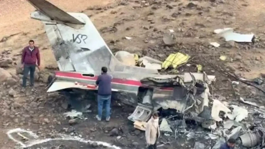
An Alaska plane crash at an isolated military installation on the state’s southwest coast has claimed eight lives, and investigators now say the aircraft was attempting to land for the second time in thick fog when contact was lost.
The disaster unfolded around midday Thursday at the Cape Newenham Long Range Radar Site, roughly 450 miles west of Anchorage.
Flying Blind on the Final Approach
Clint Johnson, who heads the National Transportation Safety Board’s Alaska region, laid out the sequence during a virtual briefing Friday. According to him, neither pilot could actually see the gravel airstrip during the descent. Both were relying entirely on cockpit instruments to guide the aircraft down.
Visibility was poor enough on the first attempt that regulations left the crew no choice but to break off the approach. They circled back and tried again. That second attempt ended with the aircraft going down approximately one-third of a mile short of the runway.
Terrain That Leaves Little Margin
The location itself compounds the difficulty. Mountains surround the airstrip on three sides, creating an approach corridor with almost no room for error. Federal Aviation Administration guidance for the site specifically advises pilots to depend on GPS and other instrument systems when landing there.
In conditions like Thursday’s, that guidance becomes less of a recommendation and more of a necessity.
Who Was on Board
The eight people killed included the two pilots, two staff members from the U.S. Army Corps of Engineers, and four contractors.
Two of those contractors worked for Calista Brice, a group of companies specializing in construction, engineering and logistics work in hard-to-reach parts of the state. Calista Brice operates as a subsidiary of Calista Corp., an Alaska Native regional corporation.
The Army Corps described its two employees as members of a project delivery team traveling to a work site in support of the Air Force. Neither the Corps nor the military has disclosed what specific work the group was scheduled to perform.
A Cold War Outpost Still in Service
The radar station has a long history. It went up in the 1950s as part of an early-warning chain intended to detect a Soviet missile launch. Decades later, its mission has shifted rather than disappeared. The installation now watches airspace stretching toward Russia, North Korea and China.
The original manned outpost shut down in 1983 after newer radar equipment was installed. Since then, the location has seen only occasional visits from civilian contractors handling maintenance.
The airstrip belongs to a private military facility administered by the Pacific Air Forces Regional Support Center. It forms one node in a broader network monitoring aircraft moving through Alaskan airspace and along the state’s borders.
Weather That Turned Quickly
Conditions were deteriorating rapidly as the flight approached. Carrie Haisley, meteorologist in charge at the National Weather Service’s Alaska sector operations center, described a striking shift in the readings.
An automated observation station near the airport reported a low cloud ceiling, fog, and visibility around 10 miles in the minutes leading up to the crash. The following update, taken roughly 15 minutes afterward, showed visibility had collapsed to under a quarter mile.
That kind of swing gives pilots almost no warning and can transform a marginal approach into an impossible one within a single circuit.
Questions About the Decision to Try Again
Mike O’Donnell, who spent much of a 17-year FAA career overseeing airport safety programs and accident investigations, offered a blunt assessment. Based on the reported conditions, he suggested the crew should have abandoned the destination entirely and diverted to an alternate field.
That judgment call sits at the center of many remote-airfield accidents. Diverting carries real costs in fuel, time and logistics, particularly in a region where alternate airports may be far away. But attempting a second approach into rapidly worsening fog carries a different kind of cost.
The Investigation Ahead
NTSB investigators were en route to the site Friday. Search crews had already located the wreckage, which Johnson described as fragmented.
One advantage investigators do have is data. Radar equipment at the site itself captured the aircraft’s final flight path, giving the board a record of the approach that may prove central to understanding what went wrong.
The aircraft was a twin-engine Cessna 441, commonly known as the Conquest. The flight was operated by Security Aviation, a charter company based in Anchorage. The company had not responded to requests for comment.
Reaction From Military Leadership
Air Force Lt. Gen. Robert Davis, who commands Alaskan Command, the Alaskan NORAD Region and the Eleventh Air Force, issued a statement Thursday describing those aboard as committed professionals performing essential work under demanding circumstances.
He characterized the crash as a devastating blow to both the military community and the surrounding populations it serves.
The Broader Context
Aviation in Alaska operates under conditions that would be considered extraordinary almost anywhere else. Vast distances, minimal road infrastructure and unpredictable weather make air travel indispensable and unusually hazardous.
Remote sites like Cape Newenham exist precisely because they are far from everything else, which is also what makes reaching them dangerous. Crews servicing them frequently face short gravel strips, limited approach aids and weather that can change faster than forecasts can track.
The NTSB’s findings will take months to finalize. In the meantime, the accident stands as another reminder of the risks carried by people whose jobs require them to fly into places most aircraft never go.
Author