

The latest Iowa rainfall totals paint a striking picture of just how much water fell across central Iowa overnight Thursday into Friday. Some communities were buried under more than a foot of rain in a matter of hours, triggering dangerous flooding, closing a major interstate, and even forcing the evacuation of a hospice facility. For residents waking up Friday morning, the scale of the deluge was hard to overstate.
A Night of Relentless Rain
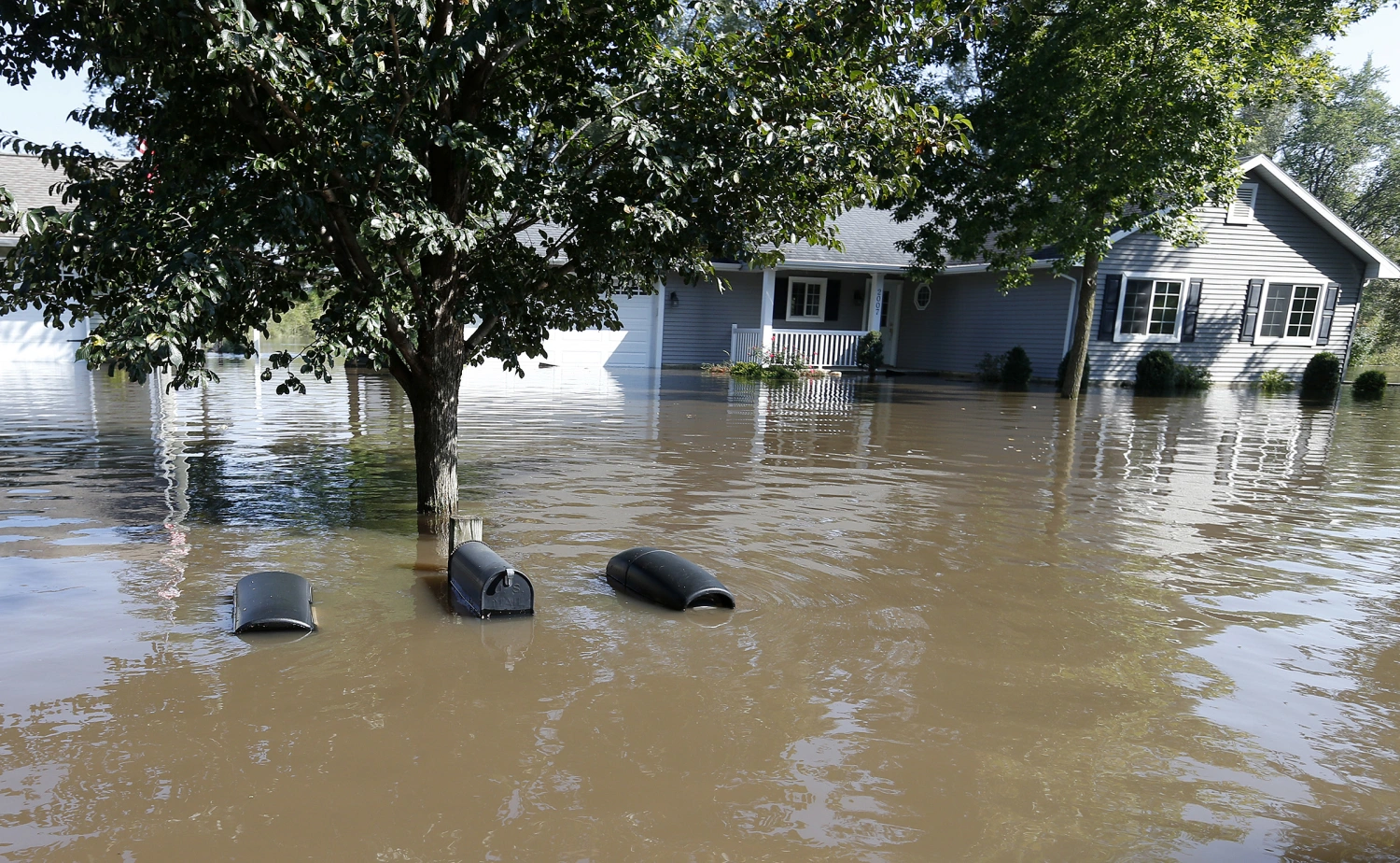
Heavy storms parked themselves over the region and refused to budge, dumping extraordinary amounts of rain on towns north and east of Des Moines. The result was widespread flooding, with water spilling onto roadways and swallowing low-lying areas. Conditions grew serious enough that a stretch of Interstate 35 between Ankeny and Elkhart had to be shut down as floodwaters overwhelmed the highway.
The morning brought a brief window of relief, with the rain expected to ease as the day wore on. But forecasters cautioned that Iowans shouldn’t get too comfortable — another round of storms was on the table for Friday evening, raising the risk of even more water in already saturated areas.
Where the Heaviest Rain Fell
By around 9 a.m. Friday, the numbers coming in from across the region were staggering. The town of Elkhart topped the list, with a jaw-dropping 12.60 inches. Nearby Alleman wasn’t far behind at 12.57 inches, and Polk City recorded a full 11 inches.
Here’s a look at some of the hardest-hit communities:
- Elkhart: 12.60 inches
- Alleman: 12.57 inches
- Polk City: 11.00 inches
- Ankeny: 9.27 inches
- Maxwell: 8.54 inches
- Collins: 8.45 inches
- Pleasant Hill: 7.00 inches
- Huxley: 6.50 inches
- Mitchellville: 5.50 inches
- Slater: 5.50 inches
The heavy totals didn’t stop there. A number of other towns saw substantial rainfall as well, including Granger at 5.34 inches, Mason at 5.25 inches, Bondurant at 5.20 inches, and Roland at 5.09 inches. Laurel picked up 4.80 inches, while Valley Junction measured 4.50 inches and Ames tallied 4.35 inches.
Closer to Des Moines, the readings remained significant. Water Works Park recorded 4.17 inches, the Ankeny Airport logged 4.10 inches, and Newton reached an even 4 inches. Altoona, Nevada, and Webster City all landed in the high threes, with 3.97, 3.94, and 3.83 inches respectively.
Moderate Totals Across the Wider Area
Farther out, plenty of communities still saw meaningful rain, even if they escaped the worst of it. Runnells collected 3.66 inches, while Des Moines’ Tower Park and the Des Moines Airport recorded 3.65 and 3.56 inches. Story City, New Providence, and Bode each hovered around the three-and-a-half-inch mark.
Other notable figures included:
- Eagle Grove: 3.12 inches
- Hartford: 2.89 inches
- Johnston: 2.85 inches
- Windsor Heights: 2.77 inches
- Grimes: 2.63 inches
- Dallas Center: 2.58 inches
- Waukee: 2.52 inches
- Summerset: 2.49 inches
- Adel: 2.42 inches
- Marshalltown: 2.38 inches
Rounding out the list, Des Moines’ Lower Beaver area saw 2.31 inches, while Madrid and Norwalk each recorded 2.17 inches. On the lighter end, Perry and Pleasantville measured just over an inch, at 1.07 and 1.02 inches respectively.
When Flooding Turns Critical
The consequences of all that rain went well beyond soggy lawns and detoured commutes. In one of the more sobering developments, UnityPoint was forced to evacuate a Des Moines hospice facility as floodwaters threatened the building. Moving vulnerable patients out of harm’s way underscored just how serious the situation had become for some communities.
Emergency crews spent the morning responding to flooded roads and stranded vehicles, and officials urged residents to avoid driving through standing water — a reminder that even shallow flooding can be deceptively dangerous.
Why Your Rain Gauge Might Tell a Different Story
One thing worth keeping in mind is that rainfall can differ dramatically from one neighborhood to the next, especially during thunderstorms. It’s entirely possible for two towns just a few miles apart to record wildly different totals. So if your backyard gauge doesn’t match the official figures, that’s not unusual — localized storms are notoriously uneven.
If your community didn’t appear in the totals, there are a couple of likely explanations. Either the area picked up less than a tenth of an inch, or no report had come in yet by the time the numbers were compiled. Residents with their own measurements are encouraged to share them by emailing weather@kcci.com, helping build a fuller picture of the storm’s reach.
Looking Ahead
For now, central Iowa is left to dry out and assess the damage from a truly remarkable soaking. With more storms possible in the evening hours, the region isn’t entirely out of the woods just yet. Residents are advised to stay alert to changing conditions, keep an eye on local forecasts, and be ready to adjust plans if additional heavy rain develops.
The overnight downpour will likely be remembered as one of the more intense rain events the region has seen in recent memory — a powerful reminder of how quickly a summer storm can turn into a genuine emergency.
Author