

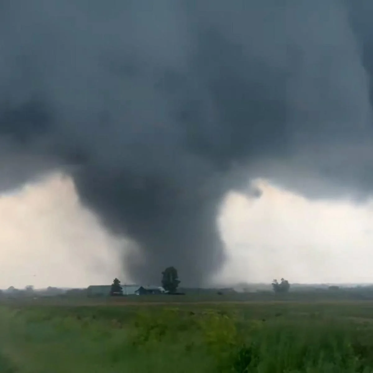
A violent tornado outbreak tore across the Midwest and Plains over the weekend, leaving at least three people dead and a trail of devastation stretching across multiple states. The storms flattened homes, downed power lines, and shattered records, marking one of the more destructive severe weather events of the year so far.
The deadly system swept through Illinois and Indiana on Sunday after an earlier tornado claimed a life in Kansas. As communities began assessing the damage, forecasters warned that the danger wasn’t over, with the storm threat set to shift eastward and put millions more people at risk.
A Record-Breaking Day of Tornadoes
The scale of the outbreak was striking. The Storm Prediction Center logged nearly three dozen tornado reports across Illinois and Indiana as powerful supercell thunderstorms barreled through the region.
For Illinois, Sunday’s storms added to what had already been an extraordinary year. According to Illinois State Climatologist Trent Ford, the state had recorded 149 tornadoes as of June 17, breaking the previous annual record of 142 set just a year earlier in 2024. The relentless activity has made this one of the most tornado-active years in the state’s history.
But the tornadoes were only part of a much larger and more widespread burst of severe weather. Damaging winds swept across the Midwest and Plains, knocking out power to tens of thousands of people and creating dangerous conditions over a vast area.
Lives Lost in Illinois and Kansas
The human toll was concentrated in rural communities hit hardest by the storms.
In Jefferson County, Illinois, located about 90 miles southeast of St. Louis, at least two people were killed. According to county Sheriff Jeff Bullard, both victims died in separate mobile homes that were destroyed roughly two to three miles apart. A third home was completely leveled, and five other people were hospitalized with injuries that were not life-threatening.
The destruction in the county was extensive. Deputy Emergency Management Coordinator Keith Hertenstein reported that at least 20 homes were damaged, with fallen trees and downed power lines leaving some residents without electricity.
Earlier that same day, tragedy struck in Sedgwick County, Kansas, where one person was found dead after a manufactured home was blown off its foundation by an EF2 tornado. The county confirmed the death, and the National Weather Service later verified the tornado’s strength.
Widespread Damage Across Indiana
Southern Indiana also bore the brunt of the storms. In Gibson County, Sheriff Bruce Vanoven said around 30 homes were damaged, with some completely destroyed. One farmstead lost everything, including its house and barn.
Among the casualties of the storm was the nearly 100-year-old Blythe Chapel in Owensville, which was destroyed. The outbreak also exposed gaps in local warning systems. While Gibson County’s tornado sirens were activated, some sirens in Owensville and Princeton failed to sound due to their age. Officials are now replacing those sirens and upgrading the system so it can be activated directly by the National Weather Service. Notably, none of the areas where sirens malfunctioned suffered tornado damage.
In neighboring Warrick County, the storm tore through a retirement community. Sheriff Mike Wilder described how two roofs collapsed at the Park Place Apartments in Newburgh, trapping a woman who had to be rescued by emergency officials. She and two others suffered minor injuries but declined treatment at the scene.
Eyewitness Accounts of Terror
For those who lived through it, the experience was harrowing. In Newburgh, a woman visiting her parents watched in disbelief as a tornado ripped through a parking lot and pool, with debris flying in every direction.
Ka’Lisha Puckett recounted the terrifying moment to CNN, describing how the tornado struck just 200 yards from her vehicle as she sat with her car in reverse, ready to flee. She said firefighters knocked on her parents’ door at their apartment complex to prepare them to evacuate because of roof damage. Moments like these captured the sheer unpredictability and danger of the day’s storms.
A Powerful Derecho Strikes the Plains
Farther west, a different but equally dangerous weather phenomenon unfolded. A long-lived and powerful thunderstorm cluster known as a derecho carved a continuous path of wind damage from southwest Kansas into Oklahoma, according to a preliminary National Weather Service report.
The derecho’s intensity was remarkable. It produced wind gusts over 80 mph when it first erupted Sunday evening in southwest Kansas, then raked through western and central Oklahoma after midnight with gusts topping 100 mph.
The damage piled up quickly:
- In El Reno, Oklahoma, six homes were damaged, with three reduced to piles of rubble. There were no reported injuries, though the city arranged hotel accommodations for three displaced families.
- About 100 miles northwest, in Woodward County, a BNSF train derailed just after midnight during a powerful thunderstorm. Roughly a mile-long stretch of train cars was blown over.
Sheriff Keith Frutiger said he was unsure whether the train was in motion when the incident occurred. Some of the toppled cars carried hazmat placards, but no leaks were reported, and hazmat teams were called in to help right the cars.
The Threat Shifts East
Unfortunately, the danger didn’t end with the weekend. The same storm system was expected to flare up another round of potentially damaging storms across the East and South on Monday, though the risk of tornadoes was considered low.
Several major cities found themselves in the path of the next wave. Atlanta, Charlotte, Philadelphia, and Washington, DC, were among those placed under a Level 2 of 5 risk for severe thunderstorms. The primary concern was damaging wind gusts capable of toppling trees and knocking out power.
Beyond the wind threat, heavy rain posed additional hazards. Forecasters warned that downpours could trigger flash flooding and slow travel from the Mid-Atlantic to the Southern Plains. Fortunately, the heaviest rain was expected to stay north of the Gulf Coast areas that had been ravaged by flooding the previous week.
What to Watch Going Forward
As recovery efforts begin across the hardest-hit communities, several developments remain worth following:
- The full extent of damage and any updates to the casualty count as assessments continue.
- How quickly power can be restored to the tens of thousands left in the dark.
- The progress of the eastern storm system and its impact on major population centers.
- Whether flash flooding materializes across vulnerable areas.
A Sobering Reminder
This tornado outbreak serves as a stark reminder of how quickly severe weather can turn deadly and reshape entire communities. From record-breaking tornado counts in Illinois to a destructive derecho sweeping the Plains, the weekend showcased the sheer power and unpredictability of nature.
For the families who lost loved ones and homes, the road to recovery will be long. As the storm system pushes east, residents in its path are urged to stay alert, heed official warnings, and take precautions against the continuing threat.
This remains a developing story, and additional details may emerge as communities continue to assess the damage and the storm system moves across the country.
Author