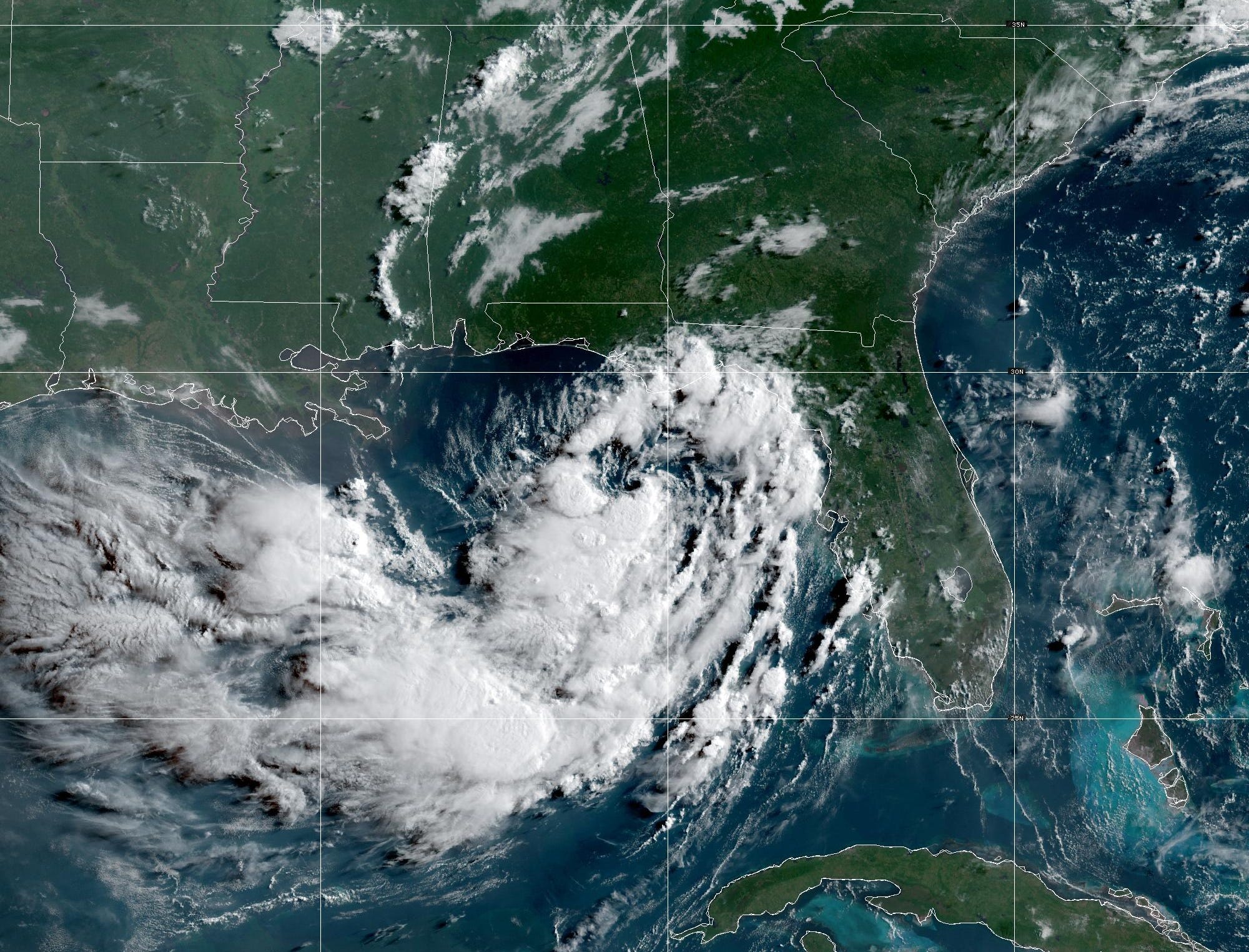
Tropical Storm Bertha is inching its way across the northeastern Gulf, and while it may never become a powerhouse, it is shaping up to be a soggy, drawn-out nuisance for a long stretch of coastline from Florida to Louisiana.
Forecasters expect several days of persistent rain, gusty winds and rising water levels along the northern Gulf Coast as the system slowly grinds westward.
A Storm With a Name but Not Much Structure
Earning a name does not automatically make a system formidable, and Bertha is proof of that. Meteorologists describe it as loosely put together, with the bulk of its heaviest thunderstorms crowded into the southern half of its circulation rather than wrapped neatly around the center.
Dry air keeps working its way into the storm, interrupting the process that would otherwise let it consolidate. That is happening even though the Gulf beneath it is running near record warmth, which normally acts as high-octane fuel for tropical development.
The result is a lopsided storm that has the moisture to cause problems on land without the organization to become genuinely dangerous at sea.
A Quiet Season So Far
Bertha is only the second named system of the Atlantic hurricane season, a noticeably sluggish pace compared with the frantic seasons of recent memory.
The reason lies well outside the Atlantic. El Niño has been tightening its influence across parts of the basin, and its signature effect is stronger upper-level winds that tear developing storms apart before they can mature.
The National Oceanic and Atmospheric Administration has factored that in, forecasting fewer named systems than average across the Atlantic this year.
Where Bertha Is Headed
Current guidance sends Bertha along the Gulf Coast with landfall expected late Wednesday night somewhere near southeast Louisiana or southern Mississippi. It should still be a weak tropical storm at that point.
From there, conditions turn increasingly hostile.
Wind shear, the great destroyer of tropical cyclones, is already shoving Bertha’s thunderstorms away from its center. That displacement is the main reason the storm cannot tighten up. Add dry air and the drag of land interaction, and the forces working against Bertha considerably outnumber those helping it.
Tropical systems weaken when they lose access to warm, moist ocean air, and Bertha is heading toward exactly that situation.
There is a real chance the system simply falls apart over Louisiana. The current official outlook is slightly more generous, keeping Bertha alive as a tropical depression and nudging it toward the Upper Texas Coast by the end of the week.
Watches and Warnings in Effect
Whatever happens to Bertha’s core, the practical impacts on the coast are already locked in.
A tropical storm warning covers coastal Alabama, Mississippi and eastern Louisiana. A warning means tropical storm conditions are expected within roughly 36 hours, not merely possible.
A tropical storm watch stretches across the Florida Panhandle coast, running from the Ochlockonee River west to the Jefferson-Plaquemines Parish boundary in Louisiana. In watch areas, those conditions could arrive within 24 to 48 hours.
Forecasters have signaled that additional watches may be posted farther west along the Louisiana shoreline and into Texas over the next day or two as the picture sharpens.
What Coastal Residents Should Expect
The impacts began ramping up Monday night and are likely to linger through at least midweek. Here is the breakdown:
Rainfall
- Widespread totals of 2 to 4 inches across the region
- Up to 8 inches where the heaviest thunderstorms train over the same ground
- Coverage from the western Florida Panhandle through southern Alabama, Mississippi, Louisiana and possibly the Texas coast
- Flash flooding is a genuine concern, particularly in low-lying urban areas like New Orleans where drainage systems can be overwhelmed quickly
Wind
- Sustained winds of 39 mph or higher are possible in the warning zone covering Alabama, Mississippi and eastern Louisiana from Monday night into Tuesday
- Watch areas in the western Florida Panhandle and coastal Louisiana may see similar conditions late Tuesday night into Wednesday
- Stronger gusts embedded in thunderstorms could knock out power in scattered locations
Storm Surge
- Water levels may climb 2 to 4 feet above normal
- The affected stretch runs from the mouth of the Mississippi River in southeast Louisiana east to the Alabama-Florida state line
- A storm surge watch is in effect, meaning life-threatening inundation is possible within 48 hours
Why a Weak Storm Still Deserves Respect
There is a temptation to shrug off a disorganized tropical storm, especially one forecasters openly doubt will strengthen much. That instinct has gotten people into trouble before.
Wind category and rainfall threat are two separate things. A slow, sloppy storm that drifts along a coastline for days can drop far more water than a compact hurricane that races inland and dissipates. Bertha’s ragged structure means its moisture is spread out and moving slowly, which is close to a worst-case setup for flooding.
Storm surge is similarly indifferent to a storm’s official rating. Two to four feet of water above normal levels is enough to swamp roads, cut off low-lying neighborhoods and make coastal travel genuinely dangerous.
Practical Steps for the Next Few Days
Residents in warning and watch areas should treat this as a multi-day event rather than a single afternoon of bad weather.
- Avoid driving through flooded roadways, which remains the leading cause of storm-related deaths
- Charge devices and prepare for the possibility of short-term power outages
- Secure loose outdoor items ahead of gusty conditions
- Monitor local National Weather Service updates rather than relying on a single forecast snapshot, since the track and timing may shift
The Bottom Line
Bertha is unlikely to be remembered as a headline hurricane. It is fighting shear, dry air and its own poor structure, and it may not survive its encounter with Louisiana at all.
But a storm does not need to be strong to be disruptive. For the Gulf Coast, the next several days will be defined by soaking rain, elevated tides and the slow, grinding inconvenience of a tropical system that refuses to move along quickly.
Author