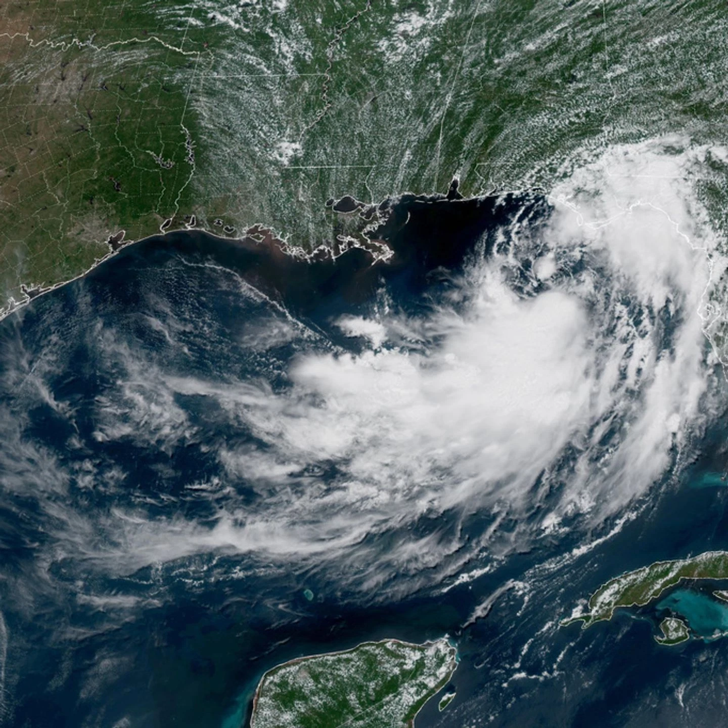
Tropical Storm Bertha spent early Wednesday soaking wide stretches of the northern Gulf Coast, and its projected track has put a long line of coastline under watches and warnings.
This is not a fast-moving storm, and that’s precisely the problem. Bertha was crawling westward at just 6 mph, and the National Hurricane Center expects that slow drift to continue through Friday.
Slow storms sit on top of places. That’s how rain totals climb.
Where Bertha Is Headed
The Miami-based hurricane center laid out the expected track in straightforward terms.
“On the forecast track,” forecasters said, “Bertha will move near or along the northern Gulf Coast during the next couple of days.”
There is some good news attached. The storm has been losing strength, with maximum sustained winds dropping to around 50 mph, and the center says gradual weakening should continue.
Bertha is the second named storm of the 2026 Atlantic hurricane season, and the forecast has it staying close to the shoreline rather than pushing inland or turning out to sea.
Who’s Under a Warning
A tropical storm warning went up Tuesday covering a substantial stretch of coastline:
- From the Bay and Gulf County line in Florida west to Morgan City, Louisiana
- New Orleans
- Lake Pontchartrain
A tropical storm watch covers additional territory to the west:
- From west of Morgan City to Cameron, Louisiana
- Lake Maurepas
The distinction matters. A warning means conditions are expected. A watch means they’re possible.
“Tropical storm conditions will continue spreading across portions of the northern Gulf Coast within the warning area through the day,” the hurricane center said early Wednesday, adding that watch areas in Louisiana could see tropical storm conditions by tonight.
Rain Is the Main Threat
Wind gets the headlines with tropical systems. Water usually does the damage.
Forecasters expect Bertha to drop 1 to 4 inches of rain through Thursday across the central Gulf Coast, running from western Florida through southern Louisiana. Isolated pockets could see as much as 6 inches.
“This rainfall may produce isolated flash flooding, especially in urban areas,” the center noted.
That urban caveat deserves attention. Cities along this coast are built on pavement and drainage systems that fill quickly. Several inches of rain falling on a saturated New Orleans or a Florida panhandle town behaves very differently than the same amount over open ground.
Storm Surge Along the Coast
Bertha is also expected to push water inland. Surge could raise levels by up to 4 feet in some coastal locations.
Four feet is not catastrophic surge by Gulf standards, but it’s more than enough to flood low-lying roads, cut off access to barrier islands and coastal communities, and cause real problems for anyone caught on the wrong side of it.
Combined with heavy rain falling at the same time, surge can also block drainage, keeping water on the ground longer than the rainfall totals alone would suggest.
What This Means for the Next Two Days
The practical picture for people in the warning area comes down to a few things.
Expect an extended period of unpleasant weather rather than a single dramatic hit. A storm moving at 6 mph takes its time.
Watch the rain more than the wind. Fifty-mph sustained winds will knock down branches and cause scattered power issues, but the flash flooding risk is what tends to strand people and damage property.
Avoid flooded roads entirely. This advice appears in every storm article for a reason: it remains the leading cause of preventable deaths in flooding events, and it applies just as much to a weakening tropical storm as to a hurricane.
Stay current with local updates. Weakening storms can still produce serious localized problems, and watch areas can be upgraded to warnings with little notice.
A Season Already in Motion
Bertha arrives only weeks after Tropical Storm Arthur, the first named system of the 2026 season, which made landfall in June along the Texas Gulf Coast.
Two named storms hitting the same general region within a short window is a reminder that the Gulf is warm and active, and the calendar has barely reached the heart of hurricane season. August and September historically bring the most activity in the Atlantic basin.
For now, the immediate concern stays local. Bertha will continue drifting west near the coast into Friday, weakening as it goes but still capable of dumping several inches of rain on communities from the Florida panhandle through southern Louisiana.
Residents in the warning zone should plan for a wet, disruptive couple of days and keep an eye on official updates as the track and intensity get refined.
Author
-
Lucienne Albrecht is Luxe Chronicle’s wealth and lifestyle editor, celebrated for her elegant perspective on finance, legacy, and global luxury culture. With a flair for blending sophistication with insight, she brings a distinctly feminine voice to the world of high society and wealth.