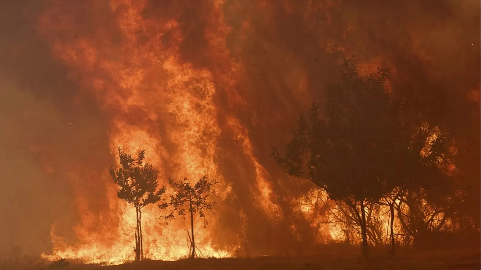
Pyrocumulonimbus fire clouds have entered the conversation in France and Spain this week, and not because meteorologists find them interesting. As both countries fight some of the most destructive wildfires in living memory, experts have raised the possibility that the blazes could begin manufacturing their own weather — a development that makes an already brutal situation considerably harder to fight.
Most people understand wildfires as something driven by conditions around them: heat, wind, dry vegetation. That holds true until a fire reaches a certain scale. Past that threshold, it stops responding to the atmosphere and starts changing it.
What a Fire Cloud Actually Is
The formal name is pyrocumulonimbus, shortened by scientists to pyroCb. In plain terms, it is a thunderstorm built by a wildfire.
The mechanism is not complicated. An intense fire releases enormous quantities of heat and energy, which drive a column of smoke and superheated air upward. As that plume climbs, atmospheric pressure drops and the rising air cools. Moisture within it condenses. A cloud forms — one made from the fire’s own exhaust.
If the fire beneath is large and violent enough, that cloud does not stop at a modest height. PyroCb formations can reach 10 to 15 kilometres, roughly six to nine miles, tall enough to punch into the stratosphere. NASA has described them as the fire-breathing dragon of clouds, which sounds like hyperbole until the dimensions register.
Rick McRae, an adjunct professor with the University of New South Wales bushfire research group, describes it plainly as a full thunderstorm forming inside the fire plume. These systems can occupy something in the order of 10,000 cubic kilometres of atmosphere, which is why their influence extends well beyond the flames that created them.
Why They Make Everything Worse
The danger comes from what the cloud sends back down.
A pyroCb generates its own wind, and those winds feed directly into the fire below, accelerating its spread. It can also produce lightning. That lightning does not stay over the burning ground — strikes can land kilometres away in untouched forest, opening entirely new fire fronts in places nobody was defending.
For crews on the ground, the practical consequence is unpredictability. Fire behaviour becomes erratic when gusts start arriving from directions the forecast never suggested. A containment line that made sense an hour ago can be outflanked. Escape routes that looked secure can close.
McRae, who spent three decades as a senior fire manager before moving into research, treats the appearance of one of these clouds as diagnostic. The cloud confirms that the fire is extremely dangerous, he says, and confirms that mass evacuations were the right call.
That reframing is useful. The cloud is not merely a hazard in itself. It is visible evidence that the fire has escaped the category of events firefighters can control directly.
New Territory for France
Australia began encountering pyroCb events around the turn of the century, and researchers there believe they have grown more frequent since. They also appeared during major California wildfires in 2022.
France may now be joining that list. If confirmed, this would be the first observation of a pyrocumulonimbus cloud over the country.
McRae frames the significance in terms of preparation rather than record-keeping. This is the first time French authorities have had to explicitly reckon with the concept, he says. Whether one formed a few days ago is less important than whether one arrives on Tuesday or Wednesday.
That distinction matters operationally. Fire agencies that have dealt with pyroCb events build doctrine around them — spotting protocols, evacuation triggers, rules about when crews withdraw. Agencies encountering the phenomenon for the first time are learning during an emergency.
Why This Is Happening More Often
The short answer is the climate crisis, but McRae pushes back on the simplest version of that explanation.
It is not merely a matter of turning the temperature dial upward, he argues. It is full-scale climate change — shifts in the atmosphere itself, changes in surface weather patterns, alterations across a range of interconnected systems. Higher temperatures matter, but so do humidity patterns, wind regimes, rainfall timing and how thoroughly vegetation dries out between wet periods.
Climate models point toward these trends intensifying rather than stabilising.
The Conditions Feeding This Season
Southern Europe has walked into an almost ideal setup for extreme fire behaviour.
Successive heatwaves have baked the region. Woodland has been drying since May with little meaningful rain to interrupt the process. Fuel that would normally hold moisture through early summer is fully cured, which means fires burn hotter and release more energy — precisely the ingredient a pyroCb requires.
The timing compounds the human cost. This is peak tourist season across the affected regions, meaning the population at risk includes large numbers of visitors unfamiliar with local roads, without established evacuation plans and often relying on rental accommodation for information.
More Heat on the Way
Forecasters have warned that another heatwave could reach France from Tuesday, with temperatures climbing toward 40C in some areas.
McRae described a mass of intense heat expected to track westward across central Europe over roughly four or five days.
That forecast is the reason his attention sits on the days ahead rather than the days behind. Another surge of heat over already desiccated terrain does not simply make existing fires harder to hold — it raises the probability that one of them produces the kind of plume capable of building its own thunderstorm.
What This Means for People on the Ground
For anyone in or near an affected zone, the practical implications are worth understanding.
A fire generating its own weather can spread in directions that contradict the prevailing wind. Spot fires can ignite far ahead of the main front. Smoke columns can collapse suddenly, sending downdrafts outward at speed.
None of that changes basic advice, but it strengthens it. Evacuation orders during an event of this kind carry less margin for delay than usual. Waiting to see how a fire develops assumes the fire will behave the way fires normally do — and a pyroCb is the atmosphere announcing that it no longer will.
Author
-
Lucienne Albrecht is Luxe Chronicle’s wealth and lifestyle editor, celebrated for her elegant perspective on finance, legacy, and global luxury culture. With a flair for blending sophistication with insight, she brings a distinctly feminine voice to the world of high society and wealth.