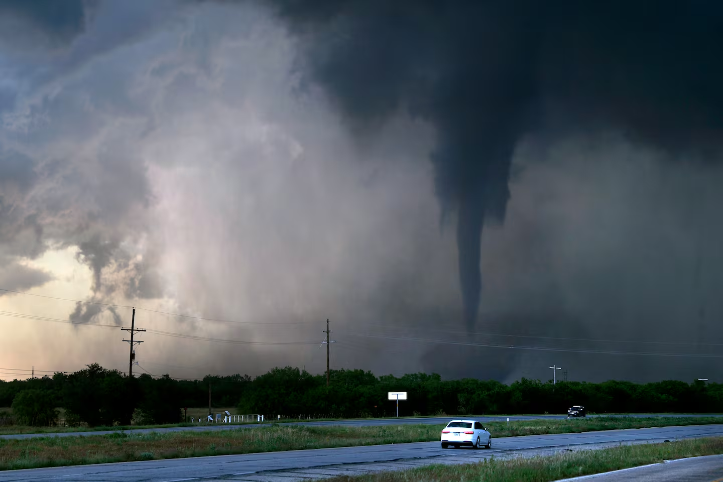
Tornado Warnings Hit Central Indiana as Flooding Threat Stretches Into Sunday
A central Indiana tornado warning was issued for Marion County on Saturday afternoon, remaining in effect until 6 p.m., as a round of severe weather moved across the region and additional counties came under similar alerts.
The warning arrived as part of a broader severe weather event that forecasters had been tracking across central Indiana for the day.
What Forecasters Expected Beforehand
The FOX59/CBS4 weather team had projected rainfall spread throughout Saturday rather than concentrated in a single burst.
Tornado probability was initially rated low for most of the state, with early guidance placing the chance at roughly 2 percent across the majority of Indiana. The elevated risk was concentrated to the south and east of Indianapolis.
That gap between a low initial probability and an actual warning is worth understanding. Percentage forecasts describe likelihood across a broad area over a full day. They do not rule anything out, and a 2 percent day still produces tornadoes when the right conditions align locally.
The Flood Watch Is the Larger Story
Early Saturday morning, the National Weather Service issued a Flood Watch covering a substantial portion of the state.
The watch area extended as far north as St. Joseph County and reached south to Monroe County. Counties bordering both Illinois and Ohio were also included, meaning the affected zone spans nearly the width of Indiana.
That watch remains active until 8 a.m. Sunday.
Why the Rain Is Sticking Around
The mechanism behind the extended threat is a slow-moving low-pressure system. Rather than passing through and clearing, the system is expected to deliver repeated rounds of rain over the same ground.
That repetition is what turns ordinary rainfall into a flooding problem. Saturated soil cannot absorb additional water, so each successive round runs off rather than soaking in.
Forecast totals exceed four inches in some locations, an amount capable of overwhelming drainage systems in a matter of hours.
Where Flooding Is Expected
The National Weather Service identified several categories of risk.
Rivers, creeks and streams are all anticipated to flood as runoff accumulates and moves downstream. Waterways can continue rising well after rainfall stops, so the danger does not end when skies clear.
Low-lying areas are also flagged, along with properties that have inadequate drainage. Those locations tend to flood first and repeatedly, and residents in them generally know from experience which spots go under.
Understanding the Alerts
The distinction between the two types of notice matters for how people should respond.
A Tornado Warning means a tornado has been detected or indicated by radar in the warned area. It requires immediate action: move to the lowest interior room available, away from windows.
A Flood Watch signals that conditions favor flooding but that it has not necessarily begun. It is a preparation notice rather than an emergency directive. If it escalates to a Flood Warning, flooding is occurring or imminent.
Practical Guidance for the Rest of the Weekend
With the watch running through Sunday morning, a few points apply.
Do not drive through standing water. This remains the leading cause of flood fatalities, and the depth is almost impossible to judge from a vehicle. Roadway beneath moving water may also have washed out entirely.
Move vehicles to higher ground if you live in an area that floods routinely. It is a small effort that prevents a substantial loss.
Keep phones charged and enable emergency alerts. Warnings during overnight hours are only useful if they reach people who are asleep.
Have an interior sheltering plan identified before it is needed. Deciding where to go during a warning wastes the minutes that matter most.
Watch basements and sump pumps. Extended rainfall over saturated ground is precisely the scenario that overwhelms them, and power interruptions during storms can stop them at the worst moment.
Why This Setup Is Tricky
Events combining tornado potential with prolonged heavy rainfall present a specific complication: the two hazards call for different responses in some situations.
Sheltering in a basement is standard advice during a tornado warning. In a flash flooding scenario, a basement is among the worst places to be. Residents in flood-prone locations should identify an interior room on the ground floor as an alternative.
That kind of conflict is rare, but Saturday’s combination of active tornado warnings and a multi-county flood watch is exactly when it arises.
What Comes Next
The immediate tornado threat is tied to the storms moving through Saturday afternoon and evening. The flooding concern persists considerably longer, with the watch extending until 8 a.m. Sunday and waterways likely to remain elevated beyond that.
Residents across the watch area should treat Sunday morning as the earliest point at which conditions begin to settle, and should continue monitoring National Weather Service updates for any escalation from watch to warning status in their county.
Author
-
Lucienne Albrecht is Luxe Chronicle’s wealth and lifestyle editor, celebrated for her elegant perspective on finance, legacy, and global luxury culture. With a flair for blending sophistication with insight, she brings a distinctly feminine voice to the world of high society and wealth.