Oregon wildfires multiplied again over the weekend, with two fresh starts lifting the state’s tally to 36 active incidents and adding pressure to crews already stretched across multiple fronts.
The count comes from the Northwest Interagency Coordination Center, the body responsible for organizing wildfire suppression across the Pacific Northwest. Its job is essentially triage at scale — deciding where limited aircraft, engines and hand crews go when more fires are burning than resources can cover.
The Two New Starts
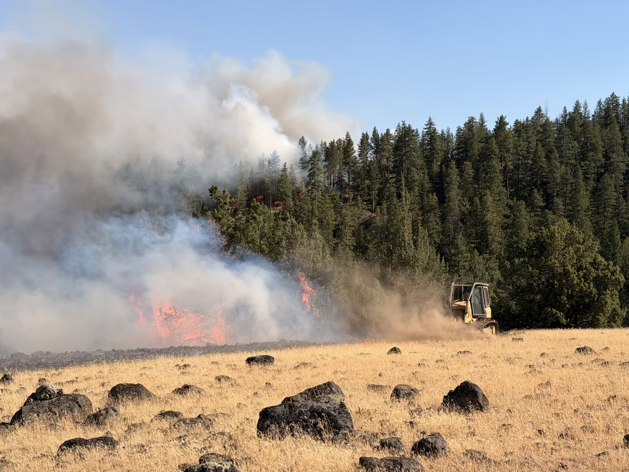
The larger of the pair ignited Saturday in grassland roughly 37 miles east of Burns and has already consumed more than 34,000 acres.
That growth rate is worth pausing on. Thirty-four thousand acres in under two days reflects the particular behavior of grass fires, which move far faster than timber fires even though they burn with less intensity. Cured summer grass carries flame across open ground at speeds that outpace anything crews can build a line against, and wind shifts can redirect a front in minutes.
The second fire started nearly 50 miles northeast of Baker City and had burned about 300 acres.
Both remained at 0% containment as of Sunday morning.
Warm Springs Under Level 3 Orders
The most urgent situation sits at the Warm Springs Reservation, where Level 3 evacuation orders remain active as two separate fires close in.
The Bench and Beachcomb fires are both burning within four miles of the reservation and continuing to expand rapidly, according to officials. Neither has any containment.
The Beachcomb fire has been the more aggressive of the two since starting Thursday, reaching 2,350 acres by Sunday.
Late Sunday afternoon, the tribal government announced it was fully closing its offices through Monday — a decision that signals both the immediate danger and the practical reality that staff cannot report to work while their own households are under evacuation orders.
Understanding Oregon’s Evacuation Levels
For anyone unfamiliar with the system, the three-tier structure Oregon uses is designed to be simple enough to act on without interpretation.
Level 1 means be ready. Conditions warrant awareness. Gather documents, medications and pet supplies, and keep vehicles fueled.
Level 2 means be set. Leaving now is a reasonable choice, particularly for anyone with mobility limitations, medical needs, livestock or children. Departure should be possible within minutes.
Level 3 means go now. This is not a suggestion or a window for packing. It means fire behavior or its projected path makes remaining unsafe, and that emergency services may not be able to reach the area afterward.
The distinction matters because the interval between levels can collapse. A neighborhood at Level 1 in the morning can be at Level 3 by afternoon if wind conditions change.
Closures Beyond the Reservation
Warm Springs is not the only jurisdiction shutting facilities.
The National Park Service has closed several parks and sites since mid-July. Among them is the Thomas Condon Visitor Center at John Day Fossil Beds National Monument, announced Saturday.
That closure stems from the Shingle fire, which has prompted the Grant County Sheriff’s Office to issue Level 2 warnings for residents in the surrounding area.
Public land closures during fire season serve several purposes at once. They keep visitors out of areas where escape routes may be cut, they reduce the chance of new human-caused ignitions, and they clear roads that crews need for equipment movement and potential retreat.
Why 36 Active Fires Is the Real Story
The individual acreage figures matter less than the aggregate number.
When a region has a handful of fires, incident commanders can concentrate resources — air tankers, hotshot crews, dozers — on the ones threatening structures. When that number climbs into the thirties, prioritization becomes brutal. Fires burning in remote terrain without immediate values at risk may receive minimal attention while crews defend communities elsewhere.
That is why containment percentages stay at zero on fires that have burned tens of thousands of acres. It usually reflects allocation rather than failure. A grassland fire far from homes will sit unattended if a 2,350-acre fire is running toward a populated reservation four miles away.
The strain compounds across the season. Crews rotating through multiple deployments accumulate fatigue, aircraft require maintenance cycles, and the Pacific Northwest competes with California, the Great Basin and the Northern Rockies for the same national pool of resources.
Conditions Driving the Season
Late July sits in the heart of Oregon’s fire window. Vegetation that greened up in spring has fully cured, relative humidity drops sharply during afternoon hours, and thunderstorms can deliver lightning without meaningful rain.
Eastern Oregon’s terrain adds its own difficulty. The high desert and grassland country east of the Cascades offers few natural barriers, and access roads can be limited, meaning crews sometimes travel considerable distances to reach a fire’s edge.
Fuel moisture, wind and topography combine differently in every incident, which is why two fires starting the same weekend can end up separated by more than 33,000 acres in size.
What Residents Should Do
For anyone living in or near affected areas, a few practices reduce risk meaningfully.
Sign up for county emergency alerts rather than relying on social media, which frequently circulates outdated evacuation information.
Keep a go-bag assembled during fire season rather than building one during an alert — documents, medications, chargers, water, a change of clothes and anything irreplaceable.
Plan for animals in advance. Livestock and horses cannot be loaded quickly, and Level 3 orders leave no time to arrange transport.
Know more than one route out. Fires close roads unpredictably, and a single blocked highway can strand an entire community.
Watch smoke conditions even well outside evacuation zones. Air quality degrades across wide distances and affects anyone with respiratory or cardiac conditions.
Where Things Stand
As of Sunday, Oregon had 36 active fires, two of them new, with Level 3 orders in force at Warm Springs and Level 2 warnings in Grant County. Containment on the most threatening incidents remained at zero.
Fire conditions change hour by hour at this stage of the season. Official county emergency management channels and the Northwest Interagency Coordination Center remain the reliable sources for current status, and residents in affected zones should assume that today’s information may be obsolete by tomorrow.
Author
-
Lucienne Albrecht is Luxe Chronicle’s wealth and lifestyle editor, celebrated for her elegant perspective on finance, legacy, and global luxury culture. With a flair for blending sophistication with insight, she brings a distinctly feminine voice to the world of high society and wealth.