An El Nino warning issued by the World Meteorological Organization on Friday says the climate pattern is intensifying rapidly and will shape global weather over the coming months, raising the likelihood of severe heat, drought and flooding across large parts of the world.
The update from the United Nations weather agency lands at a moment when much of the planet is already dealing with the consequences of extreme conditions.
Timing That Underscores the Point
The forecast arrives while Africa and Europe fight substantial wildfires and while the monsoon season causes widespread disruption across South Asia.
Those events are not themselves caused by the developing El Nino, but they illustrate the baseline conditions onto which its effects will be layered.
Guterres Does Not Mince Words
UN Secretary-General Antonio Guterres framed the situation in unusually direct language, saying El Nino is no longer approaching but has arrived and is turning up the heat inside the house.
He described what has been experienced so far as merely a warm-up act, warning that the strengthening pattern is adding fuel to a planet that is already burning.
His prescription was equally blunt. He called on governments to accelerate climate action and identified fossil fuel expansion as the central factor amplifying the crisis, urging an immediate stop to new coal, oil and gas projects.
The Numbers Behind the Alarm
The mechanism driving the forecast is measurable and specific.
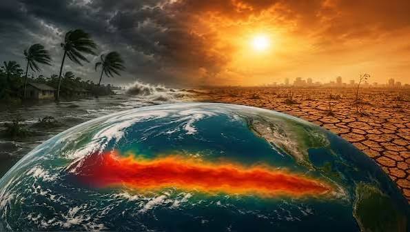
Sea-surface temperatures in the central Pacific are projected to climb more than 2.9 degrees Celsius above normal, equivalent to 5.22 degrees Fahrenheit.
That degree of warming in surface waters does not stay local. It alters atmospheric circulation patterns globally, redirecting where rain falls, where it does not, and how much heat accumulates over land.
Where the Effects Will Concentrate
The WMO expects above-normal temperatures across nearly all land areas. The strongest heat signals are forecast for:
Africa
Southern Europe
The Indian subcontinent
East Asia
South America
Several of those regions are already experiencing significant stress, which is what makes the projection concerning rather than merely notable.
Forecasts Are Not Protection
WMO Secretary-General Celeste Saulo made a point that often gets lost in coverage of climate predictions.
She noted that while El Nino is monitored closely, early warnings only matter if governments and humanitarian organisations convert them into preparation on the ground for vulnerable populations.
Her formulation was memorable: forecasts themselves do not prevent hazards, people do. The decisions taken now, she said, will determine what impacts are actually experienced later.
That distinction matters practically. Knowing a drought is likely does nothing unless water reserves are managed differently, planting decisions adjusted, or emergency supplies pre-positioned.
How Severe Could It Get
Scientists caution that this year’s event may reach record intensity when it peaks during the second half of the year.
That said, the agency is explicit that computer model projections carry meaningful uncertainty. El Nino development can accelerate, stall or shift in character, and confidence in peak-strength estimates is lower than confidence that a significant event is underway.
Why El Nino Behaves This Way
For readers unfamiliar with the mechanism, the pattern involves a periodic warming of the eastern and central Pacific that disrupts the usual trade wind circulation.
The consequences distribute unevenly. Some regions receive far more rain than normal while others receive far less, and the pattern reverses in different phases. Global average temperatures typically spike during strong El Nino years because heat stored in the ocean transfers into the atmosphere.
The Compounding Problem
What separates the current situation from earlier events is the baseline. El Nino has always produced temperature spikes, but those spikes now begin from a substantially warmer starting point than in previous decades.
That is the argument Guterres is making when he describes the pattern as adding fuel to an existing fire. The natural cycle has not changed. What has changed is the conditions it operates within.
What This Means Practically
For governments in the highlighted regions, the El Nino warning functions as a planning horizon rather than a prediction of any specific disaster. Agricultural ministries, water authorities and disaster response agencies now have several months of lead time.
Whether that time is used is the question Saulo raised, and it is the one that will determine how this event is remembered.
Author
-
Lucienne Albrecht is Luxe Chronicle’s wealth and lifestyle editor, celebrated for her elegant perspective on finance, legacy, and global luxury culture. With a flair for blending sophistication with insight, she brings a distinctly feminine voice to the world of high society and wealth.