One Last Round of Storms Before Central Indiana Finally Dries Out After Historic Flooding
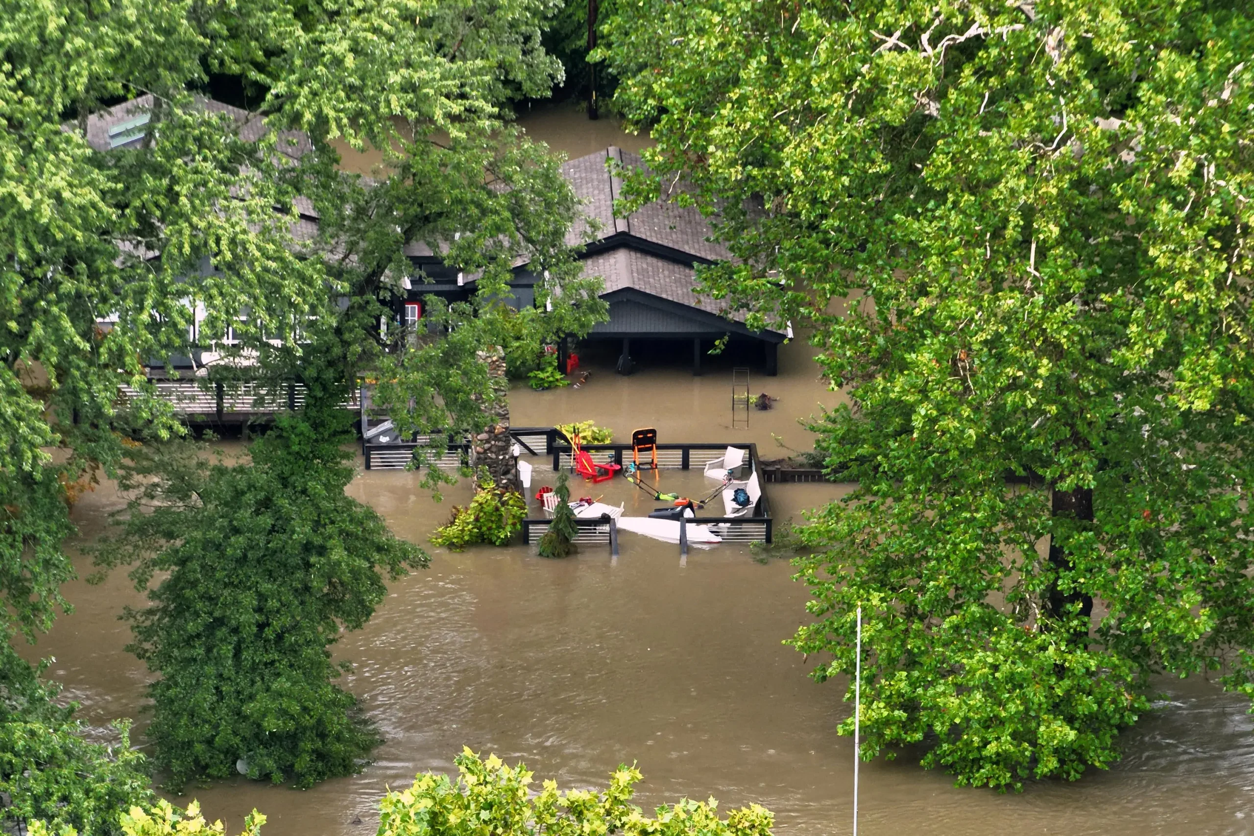
The central Indiana flooding story is nearing its final chapter, though the region has one more uncomfortable night to get through before relief arrives. After a week that rewrote record books and pushed the White River to heights not seen in generations, forecasters see an end in sight, starting Monday morning.
Until then, the atmosphere still has some unfinished business.
A Warm, Sticky Sunday
Sunday brought the kind of air that makes late summer in the Midwest feel oppressive. Dew points climbed into the 70s, creating that heavy, tropical quality where stepping outside feels like walking into a wall.
Temperatures reached near 90 degrees in a number of communities, while most other areas topped out somewhere in the 80s. Daytime rainfall stayed limited to widely scattered showers, offering a brief pause rather than a genuine break.
One Final Overnight Complex
The main concern was always the overnight hours. Forecasters flagged the southern portion of the state under a Slight Risk for severe weather, which sits at level two on the five-step scale.
Storms were expected to develop after sunset and track from west to east through the overnight and predawn hours heading into Monday. The threat profile matched what the region has already dealt with repeatedly over the past week:
Heavy rainfall as the primary hazard
Flash flooding across ground that has no capacity left to absorb water
Isolated damaging wind gusts, which forecasters declined to rule out
The wind risk is secondary. The water is the real problem, and it has been for days.
A Rainfall Stretch Unlike Anything in Recent Memory
To understand why another inch or two matters so much, it helps to look at what already fell.
Portions of northeast central Indiana were hammered mid-week with rainfall that broke records outright. Totals that would normally accumulate over the span of several months came down in a matter of hours, overwhelming drainage systems that were never designed for that kind of volume.
Indianapolis is now tracking within its five wettest Augusts on record for this point in the month. Three cities have gone further than that. Muncie, New Castle and Shelbyville have each recorded their wettest August in history, with no qualifiers attached.
Some locations picked up close to a foot of rain from a single storm system. At that point, soil saturation stops being a technical term and becomes a visible reality, with water simply sitting on lawns and fields because there is nowhere left for it to go.
The White River Rewrites Its Own History
The most dramatic consequences have played out along the White River, which has driven the majority of flooding impacts across the region. Several communities have watched water reach levels not recorded in more than a century.
Here is how the crests stacked up against the historical record:
Muncie crested at 18.64 feet at 11:30 a.m. Thursday, August 13, the seventh-highest reading ever recorded there and the highest since 1937.
Anderson set a new all-time record at 24.93 feet at 4:30 a.m. Friday, August 14, surpassing a mark that had stood since the Great Flood of 1913.
Noblesville also broke its all-time record, reaching 24.6 feet at 3:30 a.m. Saturday, August 15, another crest that displaced the 1913 benchmark.
Nora crested at 21.18 feet at 2:30 p.m. Saturday, August 15, ranking second all-time and the highest since 1913.
Ravenswood posted a new record at 16.88 feet at 5:15 p.m. Saturday, August 15, topping a mark set in 2013.
Broad Ripple reached 12.44 feet at 8:00 p.m. Saturday, August 15, the second-highest ever and highest since 1913.
The Indianapolis Museum of Art gauge crested at 20.02 feet at 10:00 p.m. Saturday, August 15, also second all-time and the highest since 1913.
Michigan Street hit 18.7 feet at 11:45 p.m. Saturday, August 15, third-highest on record and the highest since 2005.
Raymond Street reached 20.51 feet at 12:15 a.m. Sunday, August 16, tying for eighth all-time and the highest since 1990.
Stout Generating Station crested at 14.47 feet at 1:15 a.m. Sunday, August 16, third-highest ever and the highest since 2003.
What Those Numbers Actually Mean
Three new all-time records in a single event is remarkable on its own. What stands out even more is how many gauges had to reach back to 1913 to find anything comparable.
The Great Flood of 1913 remains the benchmark disaster in Indiana’s weather history. When multiple river gauges in 2026 are either matching or exceeding readings from that event, it signals something well outside the range of a typical wet week.
Relief Finally Arrives Monday
The forecast turns considerably friendlier once the overnight storms exit early Monday.
High pressure is expected to settle over the region, delivering a mostly dry Monday. A very stray pop-up shower cannot be entirely ruled out thanks to afternoon heating, but coverage should be minimal enough that most people will never see a drop.
Temperatures will moderate into the mid to low 80s on both Monday and Tuesday, right about where they should be for this stretch of August. After a week of extremes, average sounds appealing.
Looking Ahead
The next opportunity for rain arrives Wednesday as another front moves through, bringing the possibility of scattered showers and thunderstorms. Given current ground conditions, that system will be watched carefully even if the rainfall totals are modest.
Beyond Wednesday, the outlook improves considerably. Forecasters are pointing toward a genuinely pleasant stretch heading into next weekend, which should give both residents and rivers the extended break they badly need.
For now, the priority is getting through one more night and letting the water recede.
Author
-
Lucienne Albrecht is Luxe Chronicle’s wealth and lifestyle editor, celebrated for her elegant perspective on finance, legacy, and global luxury culture. With a flair for blending sophistication with insight, she brings a distinctly feminine voice to the world of high society and wealth.