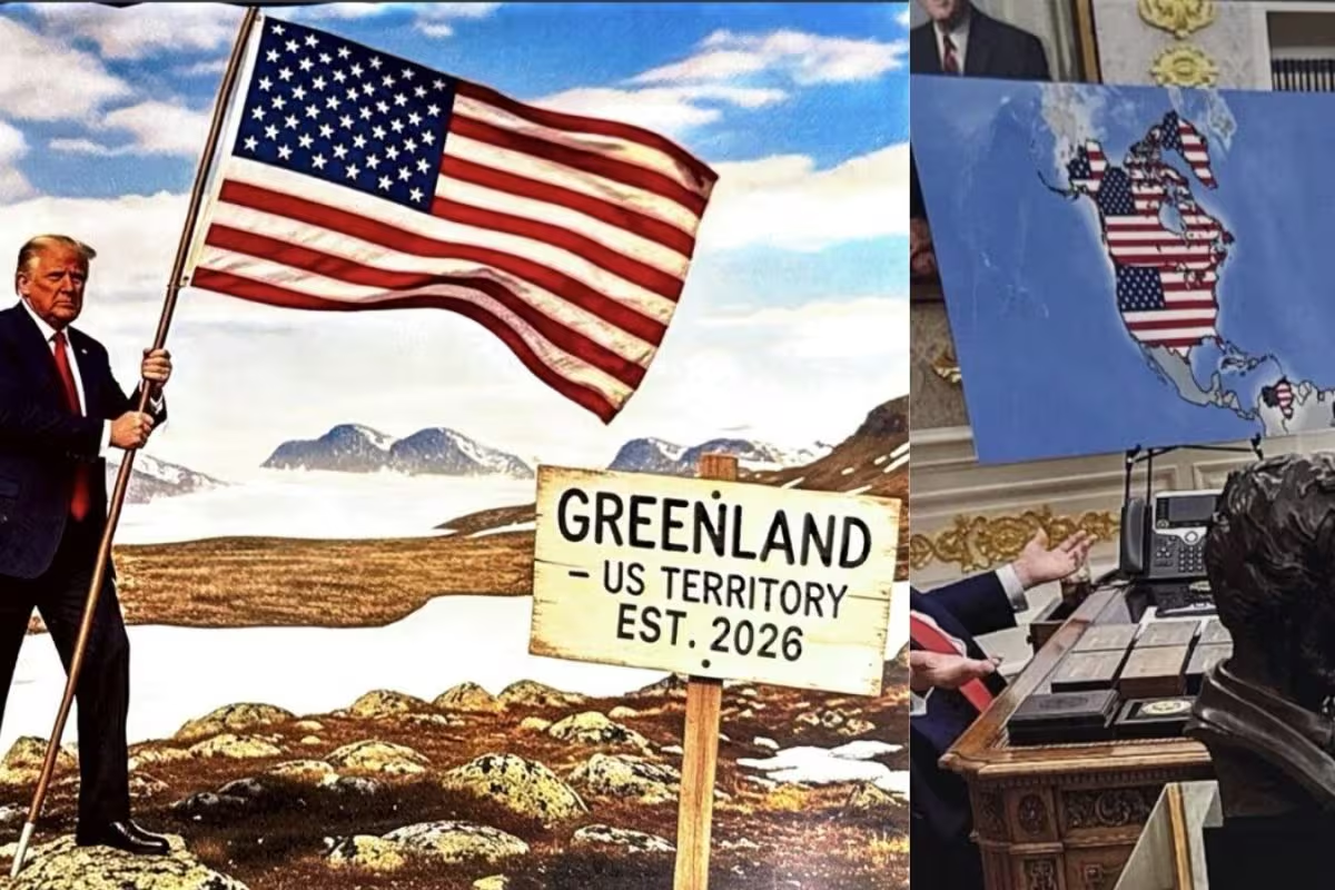
Trump Shares Map Draping the US Flag Over Canada, Mexico, Greenland and the Caribbean
The Trump North America map post that appeared on Truth Social Monday morning covered a great deal more ground than his earlier territorial talk. The image showed the pattern of the American flag laid across the United States, Canada, Mexico and part of Central America, along with Greenland, Iceland, and Caribbean islands including Cuba and Jamaica.
The president has floated acquiring foreign territory before. What has changed is the scope.
What’s New About This One
Trump’s earlier statements focused on a specific set of targets: Canada, Greenland, and the Panama Canal. Those came up repeatedly during the transition period and afterward, sometimes framed as economic arguments and sometimes as questions of national security.
Monday’s map went considerably further. Mexico and the Caribbean had not featured in his stated ambitions until now. Neither had Iceland.
Whether the image reflects any actual policy thinking or is simply provocation is unclear. Trump offered no accompanying explanation.
The Timing With Canada
The post arrived during a genuinely tense stretch in relations with Ottawa.
The two countries have spent the past month imposing tariffs on each other’s exports, and the dispute has spilled beyond trade policy into symbolism. Trump signed an executive order renaming Lake Ontario — which shares its name with a Canadian province — as “Lake America.”
Renaming a shared body of water during an active trade fight is not a subtle gesture, and Canadian officials have not treated it as one.
The New Mexico Map From the Day Before
Monday’s post followed a similar one on Sunday, and that one had its own strange origin.
A false claim had been circulating online that Trump signed an executive order changing New Mexico’s name. No such order existed. Rather than correcting the hoax, he posted an image playing along with it.
The map showed New Mexico with a large X struck through “Mexico” in the state’s name and the word “America” placed underneath. The White House’s official account reposted the image on X.
New Mexico Governor Michelle Lujan Grisham criticised the post.
The sequence is worth noting: a fabricated story spread, the president amplified the joke behind it, and the following morning he expanded the concept across an entire hemisphere.
Why the Countries Named Would Object
Each of the territories in the image has its own reasons for treating this as more than a meme.
Canada. Already in a tariff conflict, and its government has repeatedly and publicly rejected annexation talk.
Greenland. A self-governing territory within the Kingdom of Denmark. Both Greenlandic and Danish officials have stated firmly that it is not available for purchase.
Mexico. A major trading partner with a long and sensitive history regarding American territorial expansion, roughly a third of modern U.S. land having been Mexican in the nineteenth century.
Cuba. Under U.S. embargo for over six decades, with a relationship defined by mutual hostility.
Iceland. A NATO ally and sovereign state with no prior appearance in any American territorial discussion.
Symbolic Post or Policy Signal?
There is no legal mechanism behind an image on social media, and nothing in the post amounts to a formal position. But posts of this kind still carry weight.
Foreign ministries read them. Markets react to them. Allies calculate what they suggest about intent.
The pattern established over recent days — a renamed lake, a state map altered in response to a hoax, then a hemispheric flag overlay — reads less like isolated jokes and more like a running theme about American reach.
The Practical Backdrop
Beneath the symbolism sits a real trade dispute. Tariffs are in force in both directions across the U.S.–Canada border, affecting supply chains that have operated with minimal friction for decades.
Canada is among the largest trading partners of the United States. Energy, vehicles, agricultural goods, and industrial components move across that border in enormous volume, and duties on both sides raise costs for producers and consumers alike.
That dispute continues regardless of what maps get posted.
How This Tends to Land Abroad
Governments generally decline to respond formally to social media posts, which puts them in an awkward position when a head of state uses that channel to suggest their country belongs to someone else.
The usual response is to say nothing publicly and register concern through diplomatic channels. Canadian officials have been more direct than most, having faced this line of commentary repeatedly.
For countries appearing on the map for the first time — Mexico, Iceland, the Caribbean states — there may be no established response at all.
What Remains Unclear
Several questions have no answer at present:
- Whether the post reflects any internal policy discussion or was purely improvisational.
- Whether the administration intends to make further symbolic gestures of this kind.
- How the trade dispute with Canada resolves, and whether the rhetoric complicates it.
For now, the map is exactly what it appears to be: an image on a social platform, with no legal force, aimed at an audience that will read it in very different ways depending on which side of a border they happen to live.
Author