2026 Atlantic Hurricane Season Forecast Points to a Quieter Year, With a Twist
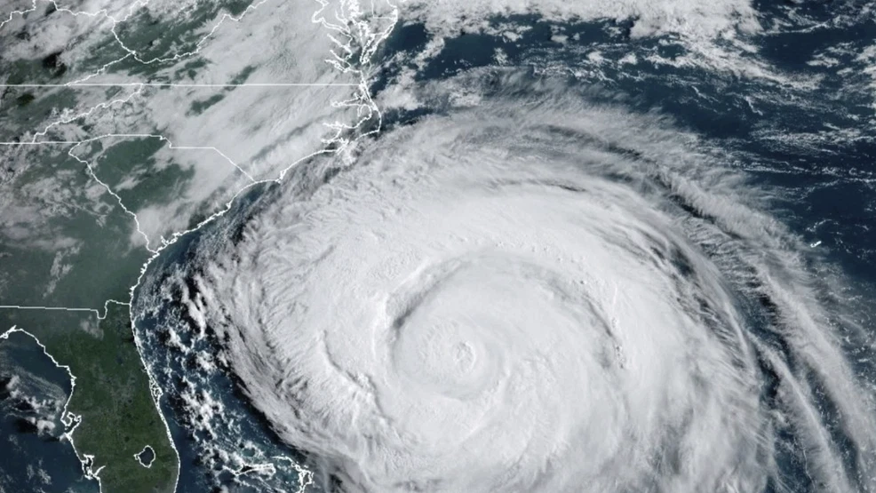
The 2026 Atlantic hurricane season forecast has officially arrived, and there’s some encouraging news for the U.S. East Coast and Gulf Coast. According to the National Oceanic and Atmospheric Administration (NOAA), this year’s Atlantic season is expected to be one of the quietest in recent memory. However, the news isn’t entirely calm. While the Atlantic may catch a break, the Eastern Pacific Ocean could be unusually active, potentially bringing trouble to the West Coast and Hawaii.
The forecast covers the official Atlantic hurricane season, which runs from June 1 through the end of November. While early projections offer some optimism, scientists are quick to remind the public that hurricane seasons are unpredictable, and even quieter years have produced devastating storms.
A Below-Normal Atlantic Season Expected
NOAA’s official projection calls for between eight and 14 named storms in the Atlantic this year. That places the forecast on the lower end of the typical range. For comparison, a normal Atlantic hurricane season usually includes:
- 14 named storms
- 7 hurricanes
- 3 major hurricanes (Category 3 or higher)
According to NOAA Administrator Neil Jacobs, the agency expects three to six of the named storms to become hurricanes this year, with one to three of them potentially developing into major hurricanes. That would make 2026 one of the slowest Atlantic seasons in recent years if predictions hold.
The El Niño Effect Is the Main Driver
The primary reason for the quieter forecast is the near certainty that an El Niño weather pattern will form this summer. This global phenomenon is expected to persist into the fall, acting as a kind of natural lid on Atlantic storm development.
El Niño plays a major role in hurricane formation, especially in the Atlantic Basin, where it tends to:
- Increase wind shear at high altitudes
- Disrupt or “shred” developing hurricanes
- Cool surface waters in key regions
- Limit the formation of strong, organized storms
According to Ken Graham, NOAA’s National Weather Service director, El Niño can often suppress hurricane development, although forecasting any single season comes with uncertainty.
The Public’s Idea of a “Busy Season” Isn’t Always Accurate
While forecasters look at the entire ocean basin to determine activity, most people judge hurricane seasons by how many storms make landfall in the United States. According to Phil Klotzbach, a researcher at Colorado State University, that perception is “very U.S.-centric.”
His research team issued a similar forecast in April and is expected to lower its numbers further during a June update.
He pointed out that last year’s hurricane season looked above average by scientific standards, but many Americans remember it as quiet because few major storms hit the U.S. coast. In reality:
- The 2025 season produced three Category 5 hurricanes
- Hurricane Melissa caused devastation in Jamaica with extreme winds and flooding
- The number of storms was high, even if landfall on U.S. soil was limited
In other words, a “quiet” U.S. season can still be a very dangerous global one.
El Niño Usually Suppresses Atlantic Storms, but Not Always
Although El Niño typically reduces Atlantic activity, exceptions do happen. The 2023 season is a perfect example.
That year, an El Niño was present, but Atlantic Ocean temperatures were at record highs. The combination created what scientists called a “tug of war” between El Niño’s storm-suppressing winds and the raw energy of unusually warm waters. The result?
- 20 named storms formed
- The season far exceeded initial forecasts
- Several powerful storms developed in conditions that normally wouldn’t allow them
This year, the Gulf of Mexico and the Caribbean are “almost record-warm,” according to Brian McNoldy, a hurricane researcher at the University of Miami. However, the deep tropics near the Equator are closer to normal, which could prevent runaway hurricane formation.
If that pattern holds, the season could resemble 2015, which only produced 11 named storms.
Even Quiet Years Can Be Dangerous
It’s tempting to assume that fewer storms automatically means a safer season. History shows otherwise. Some of the most damaging individual hurricanes have happened in otherwise quiet seasons.
A few notable examples include:
- Hurricane Joaquin in 2015 damaged the central and southeastern Bahamas and led to the sinking of the cargo ship El Faro
- Hurricane Michael in 2018 hit the Florida Panhandle as a Category 5 storm, wiping out coastal homes despite a season that was supposed to be hostile to major hurricane development
- Even years with very few major storms can produce one devastating system
This is why forecasters consistently remind the public not to confuse a quiet seasonal outlook with personal safety. One storm hitting the wrong place at the wrong time can cause enormous destruction.
What the Data Says About El Niño Landfalls
Long-term data offers more perspective on what El Niño years typically mean for U.S. landfalls.
According to Klotzbach’s research:
- During the 15 warmest El Niño seasons since 1950, 11 hurricanes made U.S. landfall
- In contrast, during years dominated by La Niña, 31 hurricanes hit the U.S.
- That’s nearly three times as many landfalls during La Niña years
So while El Niño tends to bring fewer hurricanes to the Atlantic, the U.S. is not necessarily storm-free. Risks remain, especially when ocean temperatures stay unusually warm.
The Pacific Side of the Story
While the Atlantic may experience a calmer season, the Eastern Pacific could see more action than usual. El Niño typically increases storm activity in the Pacific, sometimes dramatically.
Storms forming in the Pacific usually move west, often staying away from the U.S. mainland. But not always. Sometimes Pacific storms can:
- Bring damaging winds and rain near land before pushing out to sea
- Be redirected northward by air masses
- Reach the Baja California peninsula
- Threaten the west coast of Mexico
- Even approach Southern California in rare cases
The 2023 El Niño year offers a powerful example. Hurricane Otis caught forecasters off guard when it rapidly intensified and slammed into Acapulco, Mexico. Earlier that same season, Hurricane Hilary made a dramatic push toward Southern California, drenching the desert Southwest with flooding rain.
This year, similar risks remain in play.
Hawaii Faces Higher Risk Too
Hawaii is another region that could see more activity during an El Niño year. While the islands are usually protected by cooler waters to the east, El Niño can open a corridor for storms to approach from the south.
Adding to the concern, Hawaii is still recovering from one of the wettest Marches on record. If a strong storm system manages to reach the islands, the already saturated landscape could lead to:
- Flash flooding
- Mudslides
- Power outages
- Significant property damage
- Threats to infrastructure and tourism
Hawaii residents and emergency response teams will need to stay alert through the summer and fall.
How Communities Should Prepare
Even with a quieter Atlantic outlook, hurricane experts urge people not to lower their guard. Preparation can make a major difference in protecting lives and property.
Recommended steps for residents in vulnerable areas include:
- Reviewing evacuation routes and plans
- Stocking emergency supplies such as water, food, and flashlights
- Securing important documents in waterproof containers
- Trimming trees and securing outdoor items
- Staying informed through official weather sources
A single storm can cause years of damage, regardless of how the broader season unfolds.
What Makes Forecasting So Complex
Hurricane forecasting blends decades of historical data with cutting-edge climate models. While accuracy has improved significantly, several variables can shift quickly throughout the season.
Key factors that influence hurricane forecasts include:
- Ocean temperature changes
- Wind shear patterns
- Atmospheric pressure shifts
- El Niño and La Niña developments
- Regional weather phenomena like the African Easterly Jet
Even with the best science, forecasting nature’s most powerful storms remains a moving target.
Final Thoughts
The 2026 Atlantic hurricane season forecast brings hopeful news for the Atlantic region, with NOAA predicting a below-normal year thanks to the influence of a developing El Niño pattern. However, this calmer outlook doesn’t mean the threat is gone. History shows that even quiet hurricane seasons can produce devastating individual storms, and rising ocean temperatures still create dangerous conditions. Meanwhile, the Pacific could face an unusually active season, potentially impacting parts of Mexico, the U.S. West Coast, and Hawaii. The overall message from forecasters is clear: stay prepared, stay informed, and never underestimate what one storm can do, no matter what the season’s overall numbers may suggest.
Author