

Tornado Confirmed After a Stormy Night
An EF1 tornado Indiana residents experienced overnight has now been officially confirmed by the National Weather Service. On Thursday afternoon, the NWS verified that a preliminary EF1 tornado struck both Scott and Jefferson counties in Indiana during a round of powerful overnight storms.
The confirmation came after a turbulent night of severe weather that left communities across the region assessing the damage.
Powerful Winds Recorded
The tornado was no minor event. According to the NWS, it produced peak winds reaching 110 mph, enough to cause significant damage along its path.
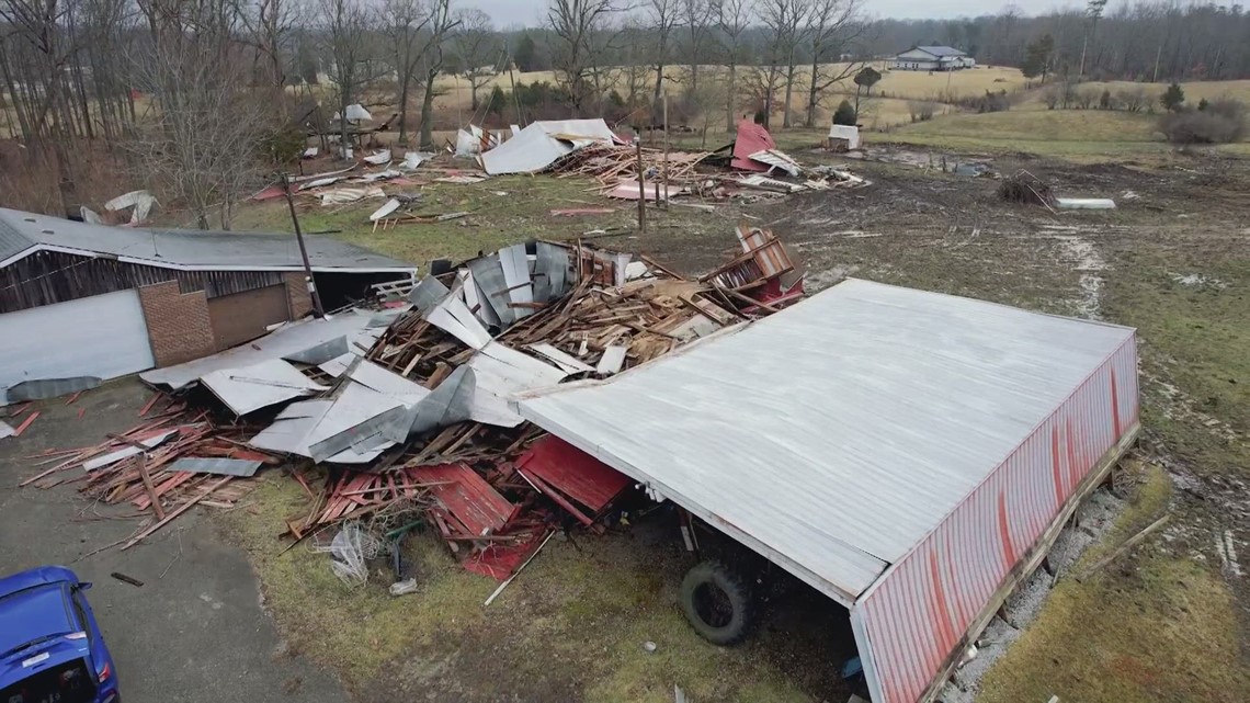
Such wind speeds are characteristic of an EF1 tornado, which can uproot trees, damage roofs, and toss around unsecured objects. The strength of the storm underscored just how dangerous the overnight conditions had become.
Severe Weather Sweeps Through Kentuckiana
The tornado was part of a larger system of strong storms that moved across Kentuckiana from Wednesday night into Thursday morning. The severe weather brought a combination of damaging winds, heavy rain, and multiple tornado reports across several communities.
As the storms pushed through the region late Wednesday and into the early hours of Thursday, the threat remained widespread. At least two radar-confirmed tornadoes were reported in parts of southern Indiana, highlighting the intensity of the system.
Jackson County Hit Hard
Among the areas affected, Jackson County, Indiana, emerged as one of the hardest hit. Reports of tornado damage surfaced after the storms swept through overnight.
The National Weather Service confirmed that the damage in the area was tornadic in nature, indicating that a tornado was responsible for the destruction. Residents in the county faced the aftermath of the powerful weather as daylight revealed the extent of the impact.
Warnings Issued Across the Region
Throughout the event, the NWS worked to keep the public informed and safe. The agency issued numerous watches and warnings across portions of Kentucky and Indiana as the storms advanced.
These alerts covered a range of threats, including the possibility of tornadoes, damaging winds with gusts up to 75 mph, and isolated hail. The widespread nature of the warnings reflected the serious risk the system posed to communities throughout the area.
More Surveys to Come
The work of assessing the storms is far from over. The National Weather Service is expected to conduct additional storm surveys in the coming days.
These surveys will help determine whether other tornadoes touched down during the overnight storms and, if so, how strong they were. The findings could provide a clearer picture of the full scope of the severe weather event.
Staying Prepared
Events like these serve as a powerful reminder of the importance of staying weather aware. As the region recovers, residents are encouraged to remain alert and stay informed about any further developments.
Keeping up with reliable weather updates and alerts can make a critical difference when severe storms strike with little warning. For now, the focus shifts to recovery and continued monitoring as officials work to fully understand the impact of the overnight tornadoes across southern Indiana.
Author