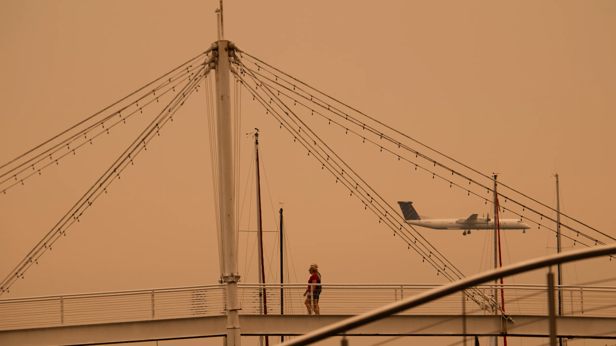
The wildfire smoke forecast most Americans want to hear comes down to one number: 24 to 48 hours. That’s roughly how long the haze from Canadian wildfires is expected to sit over much of the country before storms finally push it out.
By Friday, smoke had settled across an enormous stretch of the United States — running from the Minnesota border all the way southeast to Washington, D.C. Millions of people in affected areas received the same instruction: stay indoors as much as possible until conditions improve.
Nexstar meteorologist Blake Matthews laid out the timeline Friday morning, and the short version is that rain is coming to help.
Friday: The Worst of It
Friday afternoon and evening brought no relief for a wide corridor of the country.
Dense smoke was expected to hold steady across Minnesota, extending down through Wisconsin and Michigan, over Chicago, across Pennsylvania, and south into Virginia and the D.C. area.
The heaviest concentrations Friday night were forecast near the Ohio-Pennsylvania border, along with portions of Virginia, West Virginia, and Maryland. Those regions faced the thickest air of the entire event.
Saturday: Storms Arrive
A trough of low pressure moving in Saturday is the key to clearing things out.
That system is expected to generate showers and thunderstorms across New England and down into the mid-Atlantic. Rain physically scrubs particulates from the air, and shifting wind patterns push what remains out of the region.
The improvement won’t be instant, though. Saturday morning will still bring smoke across Buffalo and into central Pennsylvania, reaching as far south as Washington, D.C., and eastward toward New York City, Connecticut, and Providence.
By Saturday afternoon, that smoke pushes into Boston, and by the end of the day it reaches Maine — essentially the last stop as the plume exits the country.
Saturday night should look dramatically better for most of the U.S. What’s left will concentrate near the U.S.-Canada border, closest to where the fires themselves are still burning.
Sunday: Better, But Uncertain
If Saturday’s rain does its job, Sunday should be noticeably cleaner for much of the affected area.
The complication is what happens after. Nobody can say precisely when the next wave arrives.
National Weather Service meteorologist Jake Petr made the point that clearing skies from northwest winds are only a temporary fix. As long as the fires keep burning, smoky air can return. And the fires aren’t stopping soon — officials have suggested it could take months, potentially until snow arrives in Canada and northern Minnesota.
That’s the frustrating reality of this situation. The weather can move smoke around, but it can’t address the source.
The World Cup Final Question
One event has drawn particular attention: the World Cup final, scheduled for Sunday afternoon in New Jersey.
Roughly 80,000 fans are expected at the Meadowlands, an open-air stadium that hosts both the New York Giants and Jets. There’s no roof, no filtration, and no way to shield a crowd that size from ambient air quality.
Whether smoke affects the match remains unclear.
Mark Parrington, a senior scientist with the Copernicus Atmosphere Monitoring Service, flagged the specific risk. If fire activity intensifies through Saturday, additional smoke could enter the atmosphere and follow closely behind the rain — potentially arriving just as the weather clears.
In other words, the storm system that cleans the air could be followed by a fresh plume before Sunday afternoon.
What to Do While the Air Is Bad
Parrington’s guidance is straightforward and applies broadly: when pollutant levels are elevated, cut back on outdoor activity and especially outdoor exercise.
The reasoning is physical. Exercise increases breathing rate and depth, which means significantly more polluted air reaching deep into the lungs. A jog on a smoky day delivers far more particulate exposure than simply walking outside.
A few practical steps while conditions remain poor:
- Keep windows and doors shut, even if outdoor temperatures are pleasant
- Run air conditioning on recirculate rather than pulling in outside air
- Postpone workouts, yard work, and other strenuous outdoor tasks
- Watch for symptoms like throat irritation, coughing, headaches, or eye discomfort
- Take extra precautions if you have asthma, COPD, or heart conditions, or if you’re caring for young children or older adults
How to Track Conditions Yourself
Forecasts describe broad patterns, but air quality varies significantly over short distances. Smoke concentration can differ meaningfully between neighboring counties depending on elevation, wind channeling, and local conditions.
Checking a real-time air quality index for your specific location gives a far more accurate picture than a regional map. Conditions can also shift within a single day, so a morning reading doesn’t guarantee the same air by evening.
The Bigger Picture
This event follows a pattern that’s become familiar in recent years — fires burning hundreds or thousands of miles away in Canada sending smoke deep into the eastern and midwestern United States.
The distance involved surprises people. Smoke traveling from Canadian fires can degrade air quality in cities that face no fire risk whatsoever, turning wildfire seasons into a shared continental problem rather than a regional one.
For this weekend specifically, the outlook is cautiously positive. Rain should bring genuine relief starting Saturday and holding into Sunday for most of the affected region.
But relief isn’t resolution. Until those fires are out, the smoke can come back — and the calendar for that stretches well beyond this weekend.
Author