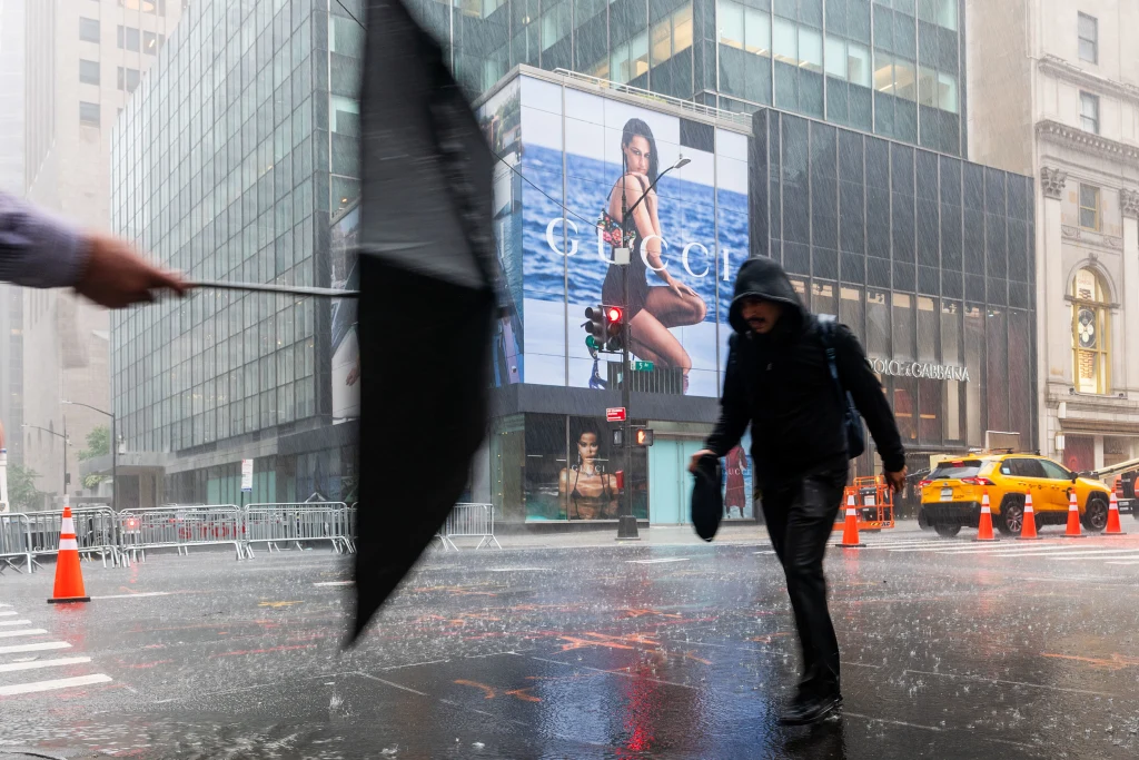
The threat of flash flooding NY and NJ residents faced through the afternoon has not fully cleared, even though the most dangerous phase of the storm system has passed. The tornado watch and severe thunderstorm watch covering the tri-state area have both been cancelled, but a flood watch remains active.
Where Things Stand Right Now
The line of storms that swept across the region has lost much of its punch. Pockets of heavy rain are still moving through the Lower Hudson Valley, northern New Jersey, New York City and Long Island. Those cells carry lightning and gusty wind, but none are currently hitting severe thresholds.
No area appears to be facing imminent flash flooding at this moment. Earlier, however, flash flood warnings were posted until 11:30 p.m. for:
- The Bronx, Manhattan and Westchester County in New York
- Bergen, Essex, Hudson and Union counties in New Jersey
What remains of the rough weather should keep drifting east and weaken over the next few hours.
Tornado Warnings Expire
The storm line sitting north and west of the city weakened enough that forecasters allowed the tornado warning to lapse at 7:15 p.m. rather than extending it.
That does not mean the area is quiet. Strong storms are still active there, and additional cells crossing New Jersey remain capable of dumping enough rain to trigger localized flooding.
How the Day Was Forecast
This was never expected to be a routine round of summer thunderstorms. A vigorous system moving across the northeastern United States pushed strong-to-severe storms into the New York City area beginning late in the morning and continuing through the afternoon and into the evening.
Forecasters flagged several overlapping hazards from the outset:
- A high probability of isolated tornadoes
- Damaging straight-line winds, described as extremely likely
- Wind gusts topping 65 mph
- Hail
- Flash flooding in coastal and low-lying areas
The National Weather Service placed much of the tri-state at level 3 on its five-point severe weather scale — a designation reserved for days when organized, damaging storms are genuinely expected rather than merely possible.
Why the Rainfall Rates Mattered
One number stood out in the pre-storm forecasts: rainfall rates potentially exceeding two inches per hour.
That figure is worth pausing on. Urban drainage systems are built around assumptions about how fast water arrives, and two inches in sixty minutes overwhelms most of them. When that much water lands on pavement and rooftops in a dense environment, it has nowhere to go but sideways and down — into basements, underpasses, subway entrances and low-lying streets.
Isolated spots were expected to pick up even more than that. It is precisely this kind of short-duration, high-intensity rain that produces the flooding scenes New York has become familiar with in recent summers.
Which Areas Faced the Greatest Risk
The hazard was not distributed evenly across the region.
The most intense thunderstorms were projected to hit the Poconos, the Catskills and New Jersey. Those areas carried the highest combined risk for tornadoes and straight-line wind damage, and severe thunderstorm and flash flood warnings became widespread there.
The flooding threat, by contrast, concentrated along a different corridor: from north and central New Jersey through metropolitan New York City, out across Long Island, and into coastal Connecticut. Low elevation, heavy development and limited natural drainage combine to make that stretch especially vulnerable when rain falls fast.
One Welcome Side Effect
There is an upside buried in a day of severe weather.
The storms did what days of stagnant air could not — they scoured out the Canadian wildfire smoke that had been settling over the tri-state and degrading air quality. A cold front following the system is expected to clear things out entirely.
The timing works out well. Sunday’s World Cup final should arrive under noticeably cleaner and calmer conditions than the region has seen recently.
What to Keep in Mind Tonight
Even as the immediate danger recedes, a few things are worth remembering.
Flood watches stay in effect for a reason. Ground that has already absorbed heavy rain has limited capacity left, meaning even a modest additional cell can produce runoff out of proportion to how much rain actually falls.
Roadway flooding is the most common danger and the most underestimated. Water depth is nearly impossible to judge at night, and moving water requires far less depth than most drivers assume to lift a vehicle. Turning around remains the correct response to a flooded road, regardless of how familiar the route is.
Storms that no longer qualify as severe can still be hazardous. A cell that fails to meet the wind or hail criteria for a warning can still produce dangerous lightning and locally intense rainfall.
Looking Ahead
The system is exiting eastward and losing organization as it goes. Forecasters expect the remaining showers and storms to fade over the coming hours.
By tomorrow, the picture should look considerably different — drier air, cleaner skies and a break from both the smoke and the storms. For a region that has spent recent days under a haze and today under a warning, that qualifies as a genuine reset.
Author